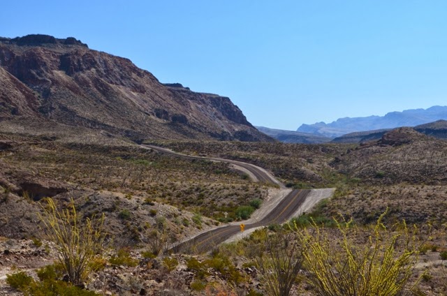
 The vast untouched reaches of Texas' Big Bend region are breathtakingly beautiful.
With the desert's low rainfall stunting plant life, there is nothing to impede views or to hide the wild expanses stretching in every direction.
The summer in Big Bend is so hot that few campgrounds and visitor centres even open, but with Autumn now bringing slightly cooler temperatures, the region is beginning to open for the season though not yet experiencing the heavy visitor traffic it sees from Thanksgiving through Spring Break.
The region encompasses the Big Bend Ranch State Park, the Big Bend National Park and several small communities in the Chihuahuan Desert on the border with Mexico.
Starting in the border crossing town of Presidio, we took the 170, the 'Camino Del Rio', which heads east through the Big Bend Ranch State Park.
Starting in the late afternoon, we nighted at an honour-system RV park not far along the road and watched with interest as a Border Patrol truck drove through not one but four times in just the twilight hours before the pitch black of night descended.
The next morning, as we followed the Rio Grande on its meandering course south-east towards its eventual 90-degree turn north-east (hence the 'big bend'), the road showcased cliffs, canyons, hoodoos and dykes in its sweeping panoramas.
What it also showed us was how easy it must be to cross the border between Mexico and the United States, with the river being not wide or treacherous whatsoever.
Later in our visit, in the Boquillas Canyon of the National Park, we watched two Mexicans simply ride their horses across the river where we had been skimming rocks to the other side just moments before.
The tiny resort town of Lajitas made a pleasant stop for a couple of nights, with the boys enjoying pool swims for the first time since we left Washington DC.
Their efforts chasing roadrunners across the lawns reminded us of Hanna-Barbera's Coyote.
The nearby golf resort has a unique longhorn museum displaying the lengthy horns of many a bull who once proudly sported them.
 Entering the National Park, we took the Ross Maxwell Scenic Drive, perhaps the highlight drive of the Park, down to the Santa Elena Canyon trail head.
The trail, about three kilometres return, took us into the midst of the Santa Elena Canyon, where the Rio Grande has sliced deeply into the rock.
The boys had fun playing with the canyon's echoes.
Back at the Cottonwood Campsite, I spotted a bobcat wandering just 20 metres away. It strolled for a while, unhurried and unbothered by us until another camper drove in and it quickly skidaddled.
The boys and I accompanied Nath on the 2.5-kilometre return route to the Juniper Canyon Overlook, a highpoint affording impressive views through the Chisos Mountains which push up out of the desert like a forested, cool oasis.
Dash spotted two tarantulas during our walk and we watched them feeling their way over the path and across the cactus debris and plantlife.
(As many of you know, I'm not a fan, but there was something innocuous about these - perhaps because they were so slow - and I surprised myself with my ability to stand still and just watch them).
Later, we drove Bessie to the Rio Grande Village, where we stayed two nights.
The next day we walked the Boquillas Canyon Trail, playing on a sandy beach at the edges of the river's gouging slice through yet more rock.
Here we skimmed rocks and contemplated the canoe on the other shore; not as sleek as a 747 but all a Mexican needs for international travel.
Indy insisted on yelling out to horsemen on the other bank, who then rode across not long after we started our walk back.
These and other locals had set up signs and displays of trinkets available 'for a donation' at regular intervals along this trail and the Nature Trail we walked on the following day, as well as on the roadside overlook to the Mexican township of Boquillas Del Carmen.
 We tried as much as possible to drink in the unimpeded views of these rugged expanses, knowing too well that as we now begin working our way eastwards there will be few other moments (on this trip at least) where we will feel like we are the only people on earth.


